
DrillerDB Media Resources
Press Kit
Logos, high-resolution data visualizations, and company facts for coverage of DrillerDB and the Underground Lithology Grid. Media contact: craig@drillerdb.com (Craig Vander Galien, founder).
Data visualizations
Credit line for all images: “Image: DrillerDB”
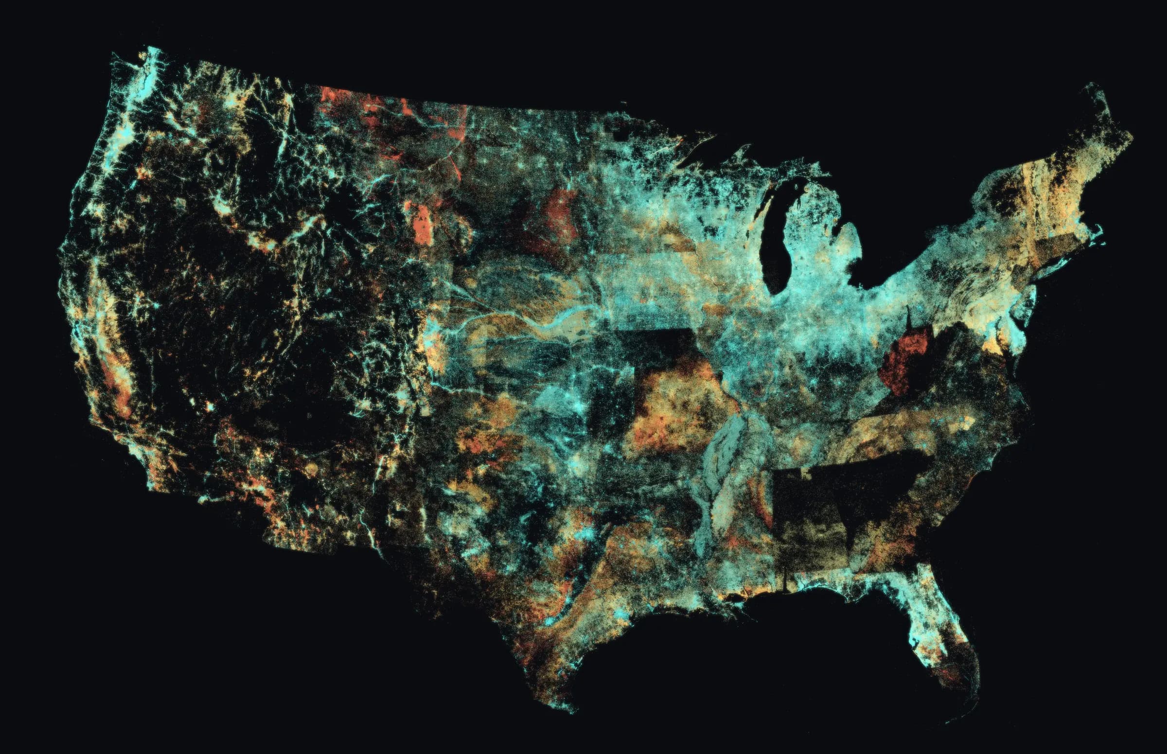
Wells by depth
The continental United States drawn entirely from the 15.9 million water well locations available when this image was rendered. The live DrillerDB database now contains about 23 million records. No base map: every point of light is a real well record. Color shows well depth (teal = shallow, amber = deeper, red = deepest).
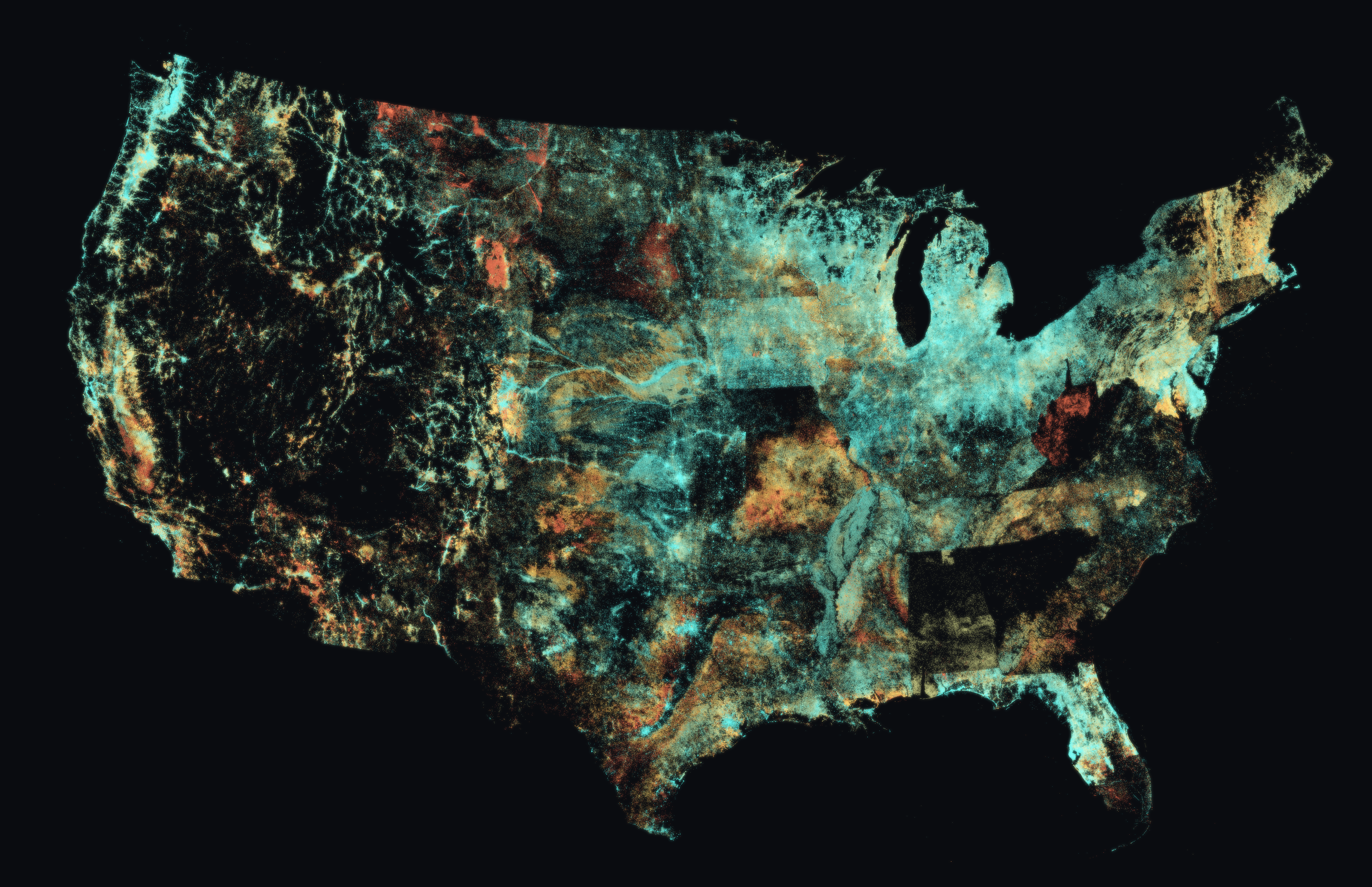
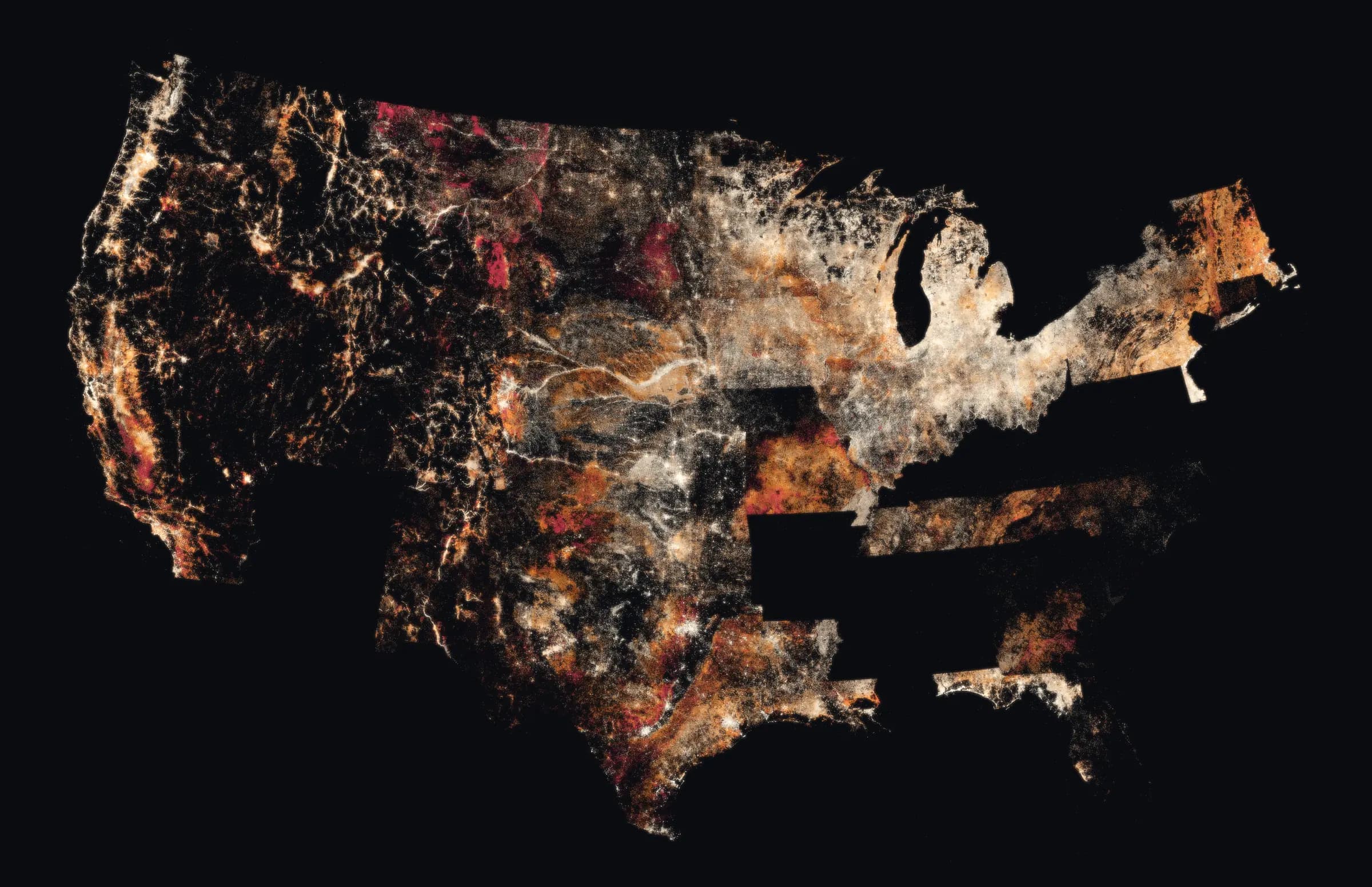
Lithology grid coverage
The 10.4 million well logs DrillerDB has extracted and standardized into the Underground Lithology Grid, drawn from their real locations. Color shows the average depth of the described wells.
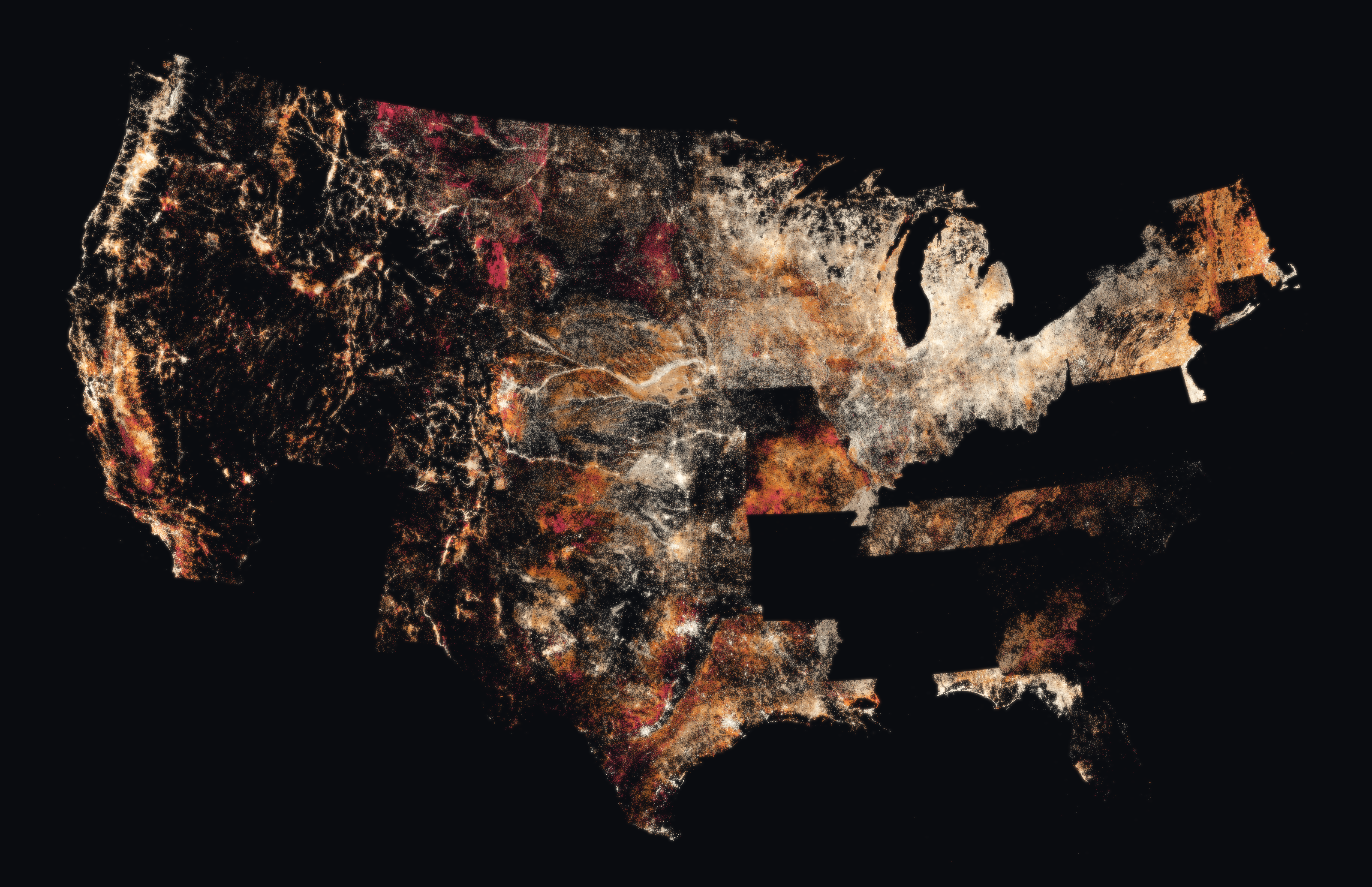
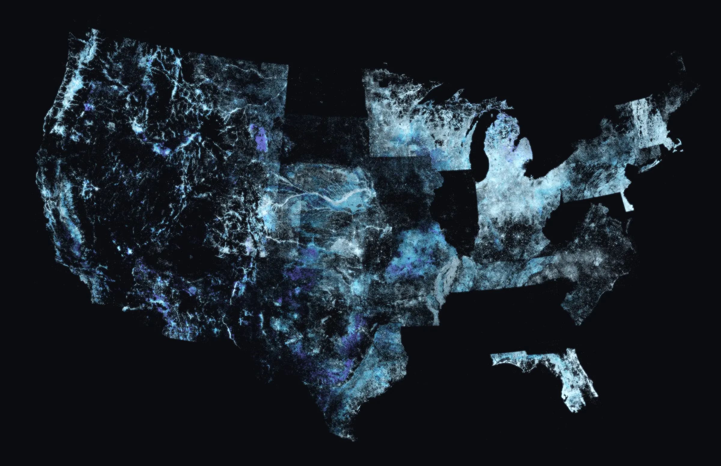
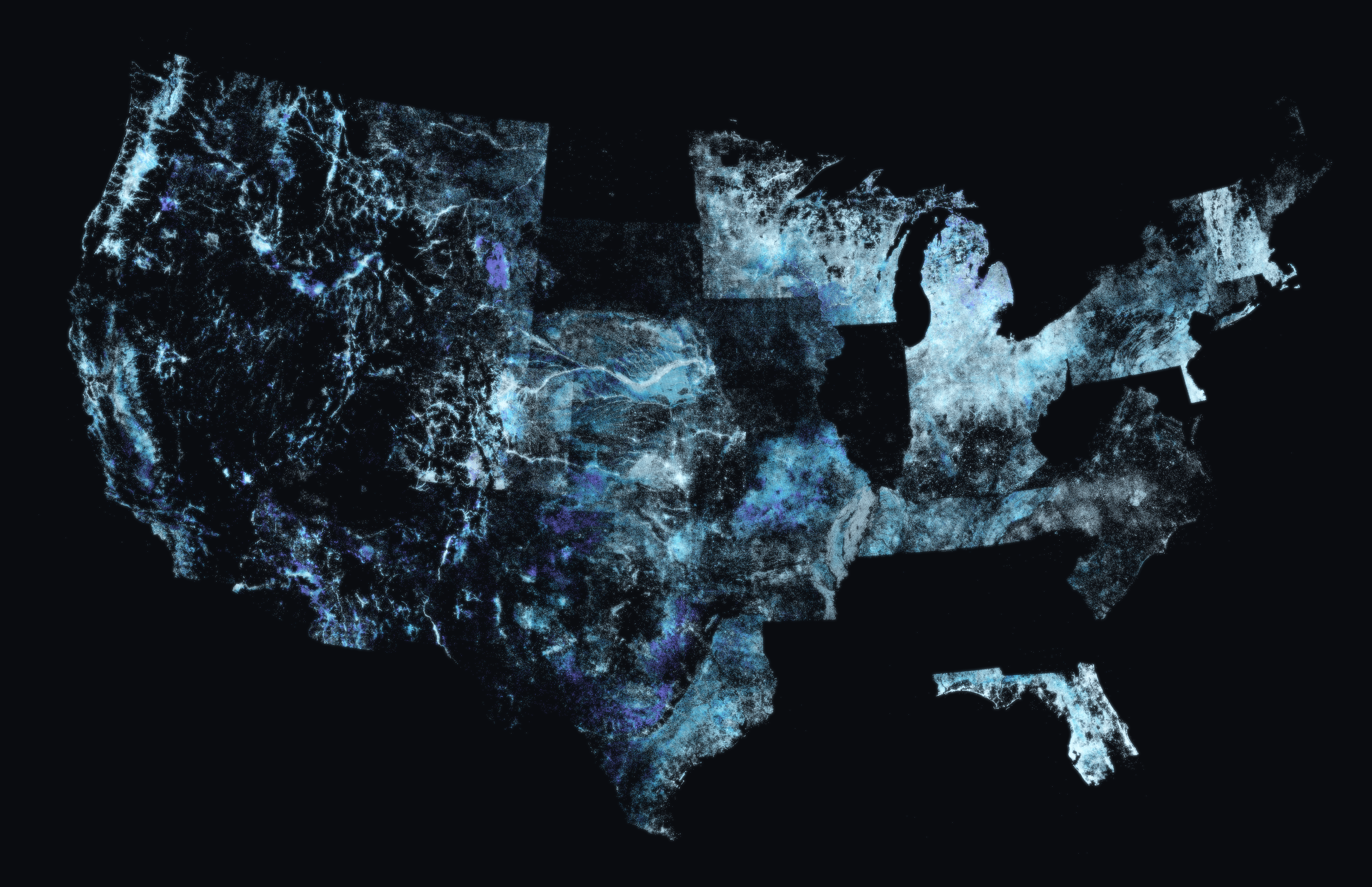
Static water levels
9.5 million static water level measurements from the DrillerDB database. Color shows depth to water (light = near-surface water, indigo = deepest water tables).
Launch film
“The Underground Lithology Grid” (60 seconds) — ground cutaways of Colorado's Denver Basin and Wisconsin's Driftless Area built from real well records. Embeddable from YouTube; credit “Video: DrillerDB.” Broadcast-quality file available on request: craig@drillerdb.com.
Coverage
The Underground Lithology Grid announcement (August 4, 2026) was carried on the AP wire and syndicated to more than 45 local news stations nationwide.
Logos



Fact sheet
One page: key figures, why the Underground Lithology Grid is new, how it was built, and the research program.
Download PDFFounder

Craig Vander Galien grew up in his family's Wisconsin water well drilling business and founded DrillerDB in 2024 to bring modern software and data to the drilling trades.
Download photo
About DrillerDB
DrillerDB builds business management software for water well drilling contractors and maintains one of the largest databases of water well records in North America - about 23 million records across the United States and Canada, including 53 million+ standardized lithology intervals. Founded in 2024, DrillerDB is based in Chicago, Illinois. The public can explore the records on the interactive well map, find licensed contractors in the contractor directory, and preview expected geology anywhere in the US with the Geology Estimator.
- Founded
- June 2024, Chicago, Illinois (DrillerDB, LLC)
- Products
- Business management software for drilling contractors (web, iOS, Android); DrillerDB Enterprise market intelligence; public well map and geology tools
- Dataset
- 23M well records (US + Canada); 53M+ standardized lithology intervals across 10M+ well logs spanning 39 US states and 6 Canadian provinces; 11M+ static water level measurements
- Research Program
- Launched August 2026: free record-level access for non-commercial academic research
Usage:logos, images, and data visualizations on this page may be reproduced for editorial coverage of DrillerDB with the credit line “Image: DrillerDB.” They may not be used commercially, altered to misrepresent the data, or used to imply DrillerDB endorsement. The underlying dataset is not public-domain; researchers can apply for record-level access at drillerdb.com/research.