Active Driller2.3 (3)
West Branch, MI 48661
Well DrillingPump InstallationPump Repair+3 more
Typical Rose City well profile: surficial sand/clay, thick clay/sandy clay, then extensive sand and gravel aquifer zones.
Showing contractors within 60 miles of Rose City. 42 results found.
Check depths and logs of existing wells in the area before you drill.
Open well map →Costs, permits, maintenance tips for private wells in Michigan.
Open guide →Not in Rose City? Search well drilling near me in the national directory, or find well service and repair near me and well pump service near me for work on an existing well.
A geological estimate for the Rose City area.
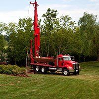
A representative Rose City well begins with a variable layer of sand, clay, or mixed sand with clay/cobbles (10-35 ft). This is typically followed by a thick clay or sandy clay sequence (15-50 ft thickness) that may contain some lenses of gravel or sandy zones. Below the main clay section, wells most commonly encounter extensive sand, sand with gravel, or sometimes fine gravel (ranging from depths of ~35-80+ ft but thickening greatly in some locations to more than 100 ft). These lower sand and gravel aquifer zones are the principal source of well water, yielding high sustainable flows. Occasional thin clay or clay/gravel partings exist but are not persistent. Median residential static water level generally falls within 23-93 ft (most between 23-80 ft). Drilling is predominantly by rotary (mud circulation) with PVC casing to near the main aquifer. Estimated residential well depth is ~80 ft for reliable 5-15+ GPM yields. High-capacity domestic or small public wells may reach 120-130 ft.
| Depth (Feet) | Formation Type | Description | Characteristics |
|---|---|---|---|
| 0 – 15 ft | Sand/Sand with clay, Cobbles possible | Fine to medium sand, sometimes with clay lenses and/or cobbles | Color: Tan to brown Hardness: Loose-Moderately firm |
| 15 – 55 ft | Clay/Sandy Clay | Dense clay or sandy clay, may include some gravel. Acts as confining layer. | Color: Grey, blue, or red Hardness: Hard |
| 55 – 80 ft | Interbedded Sand & Gravel/Clay lenses | Sand and gravel with occasional clay partings. Increasing water yield. | Color: Mixed (sand tan, gravel grey, clay grey/red) Hardness: Loose-Firm |
| 80 – 125 ft | Sand & Gravel (Primary Aquifer) | Thick, coarse sand and gravel layers with excellent hydraulic conductivity; primary aquifer for most wells. | Color: Grey, tan, brown Hardness: Loose |