
What the report proves
The first page should establish the route, nearby well evidence, mapped soils, known data gaps, and the deterministic rules that triggered each risk note.
Sample report
A BoreCast sample report should show an estimator what evidence supports the bore-risk read, what remains uncertain, and what has to be verified before mobilization.
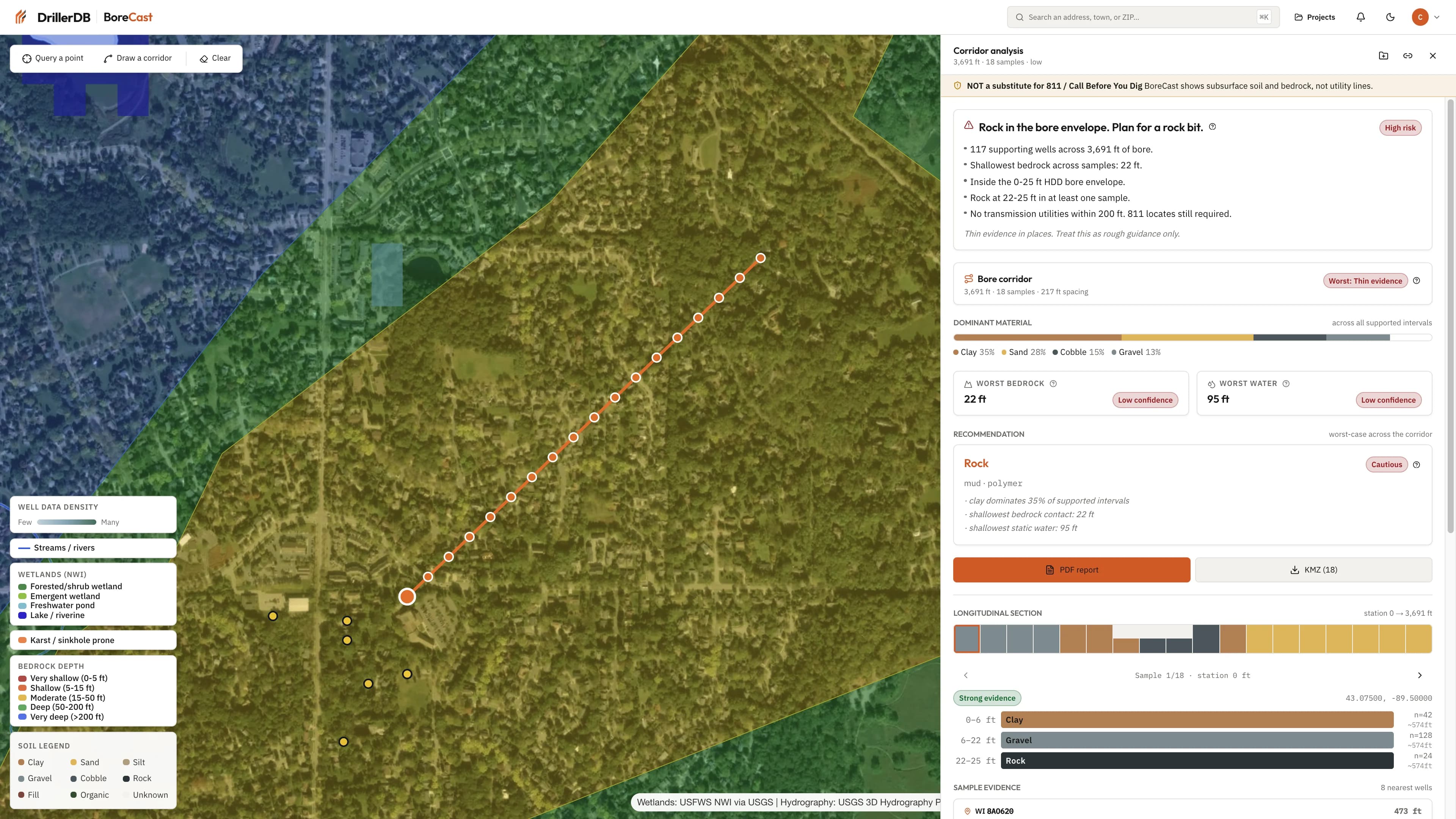
The report format keeps the source appendix, uncertainty, and next actions visible instead of burying them in fine print.
The first page should establish the route, nearby well evidence, mapped soils, known data gaps, and the deterministic rules that triggered each risk note.
The output should support a route review, contingency conversation, potholing plan, client explanation, or pre-work compliance packet.
Shows local formation, water, and depth context near the planned bore.
Limitation: Nearby logs are not a substitute for site-specific investigation.
Frames likely constructability concerns before field verification.
Limitation: Mapped data can be coarse or stale at the jobsite scale.
Preserves the bore corridor and report boundary for review.
Limitation: Bad geometry creates bad conclusions, so the input must be confirmed.
Corrections and real project outcomes are the fastest way to make these vertical reports useful. Send the exact signal and we will route it into the product feedback loop.
These pages are designed to support the product hub, sample report, and related source guides with clear crawl paths.