Drilling software built for Canada’s legal land descriptions.
DLS, Ontario, and NTS-friendly inputs. Click-the-grid map workflows. Canadian well map data, unified with the same toolchain that runs DrillerDB.
Auto-populate DLS legal locations from GPS (AB/SK/MB), and work directly off the township grid overlay in the main DrillerDB map.
Province-aware selectors for DLS (AB/SK/MB), Ontario lot/concession, and NTS workflows so your work orders and reports match how you work.
Air Rock CA field report workflows and fillable PDFs for MECP Water Well Records, pump tests, pump installations, abandonment, and service calls.
Survey systems that match the jobsite
DrillerDB detects the right survey system based on country and province, then renders the correct fields and lookup behavior where available.
DLS (AB, SK, MB)
LSD, Section, Township, Range, Meridian inputs with standardized formatting and in-app validation workflows.
Ontario (Lot / Concession)
Geographic township, lot, and concession fields for Ontario-style legal descriptions without forcing DLS/PLSS patterns.
NTS (BC)
NTS map sheet and quarter-unit fields for NTS-oriented workflows with a clear path to expand to additional regions where grid systems differ.
# Example: DLS legal description (format)
10-25-48-5-W5

# Typical field mapping in DrillerDB
strLSD:       10
strSection:   25
strTown:      48
strRange:     5
strMeridian:  W5
surveySystem: DLS
Tip: From the map in the main DrillerDB console, you can trigger legal lookups from GPS for supported provinces and keep projects/work orders consistent.
Canadian well map data, same pipeline
DrillerDB’s map and related APIs are backed by a unified wells dataset (the state_wells table), designed to scale across regions.
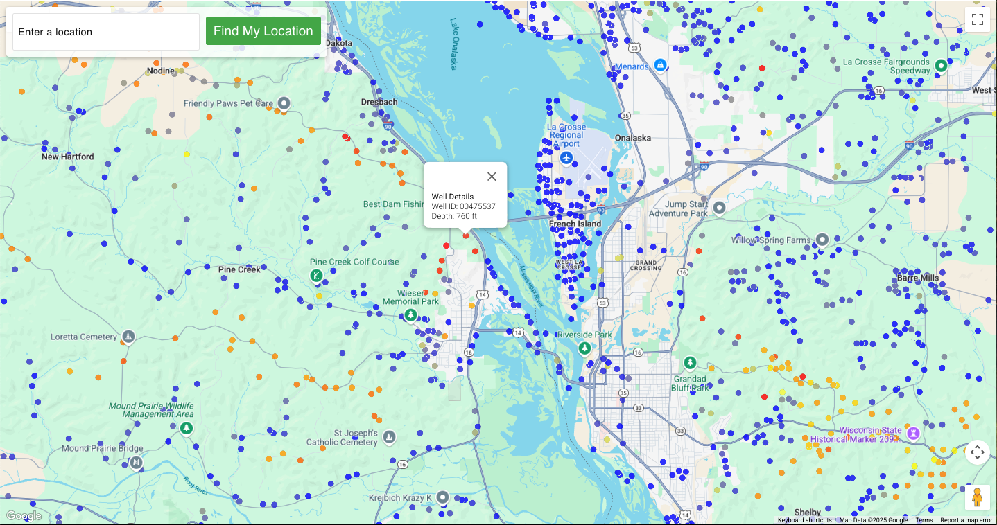
Open the map centered on Canada, then search an address or legal location. Zoom in to see wells and preview details.
Canada-first map layers
Beyond wells, DrillerDB’s map layer system supports Canadian-focused overlays to keep field decisions grounded in survey and hydrogeology context.
Township grid overlays (CA)
Township Canada vector tiles for supported provinces, plus legal-location lookup workflows inside the main DrillerDB console.
Canadian aquifers (NRCan GIN)
Optional aquifer overlays sourced from Natural Resources Canada’s GIN WMS service, alongside USGS aquifer layers for cross-border work.
Unified performance pipeline
The same tile + API pipeline that serves US map layers also powers Canadian coverage, so you get consistent speed and behavior across regions.
FAQ
Quick answers about Canada-first features in DrillerDB.