Chat with us, powered by LiveChat
NewDrillerDB Enterprise SalesSee it
Irons, Michigan

Well Drillers Near Irons, Michigan

Typical Irons, MI area wells encounter alternating sand, gravel, and clay layers, with sand/gravel being the dominant aquifer zone. Residential wells usually reach 70–80 ft for 10–15 GPM yield.

Showing contractors within 60 miles of Irons. 282 results found.

Typical depth
75 ft
Water table
29 ft
Contractors
282

282 Contractors

Sort by:

Peterson's Well Drilling Co

Active Driller
Irons, MI 49644
Residential Well DrillingCommercial Well DrillingPump Services+2 more
A & B Well Drilling logo

A & B Well Drilling

Kimball, MI 48074
Well DrillingResidential Well DrillingCommercial Well Drilling+6 more
Al's Pump Service logo

Al's Pump Service

Cheboygan, MI 49721
Pump InstallationPump RepairWell Maintenance+1 more
Atens Well Drilling logo

Atens Well Drilling

Active Driller
Manton, MI 49663
Well DrillingPump RepairWater Line Repair+1 more
Automatic Septic & Well Corp logo

Automatic Septic & Well Corp

Holland, OH 43528
Well DrillingWell Maintenance
Binz Bros Well Drilling logo

Binz Bros Well Drilling

Active Driller
Hurley, WI 54534
Well DrillingPump ServicesWell Maintenance

Cameron Brothers Well Drilling

Active Driller
Free Soil, MI 49411
Well DrillingPump ServicesPump Installation+2 more
Cluff Well Drilling Company logo

Cluff Well Drilling Company

Active Driller
Traverse City, MI 49684
Well DrillingResidential Well DrillingCommercial Well Drilling+6 more
Dan Wood Company logo

Dan Wood Company

Portage, MI 49002
Pump InstallationPump RepairWell Maintenance+1 more

Dancer & Sons Well Drlg Inc

Harrison, MI 48625
Well DrillingPump RepairConstant Pressure Systems+3 more
Dave Careys Water Well Drilling and Servic logo

Dave Careys Water Well Drilling and Servic

4.7 (66)
Rose City, MI 48654
Well DrillingResidential Well DrillingCommercial Well Drilling+6 more
Denstedt Well Drilling Co logo

Denstedt Well Drilling Co

Active Driller
Hale, MI 48739
Well DrillingWell Maintenance
Don Oehring Well Drlilling logo

Don Oehring Well Drlilling

Woodhaven, MI 48183
Well DrillingWell Maintenance
Droptiny and Sons Well Drilling logo

Droptiny and Sons Well Drilling

Pinconning, MI 48650
Well DrillingWell Maintenance

Dudgeon Well Service, LLC

Battle Creek, MI 49014
Well DrillingWell Maintenance
Dunhams Well Drilling logo

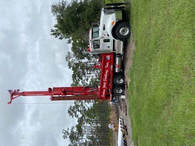
Dunhams Well Drilling

4.8 (250)
Midland, MI 48642
Well DrillingResidential Well DrillingCommercial Well Drilling+11 more

Dyer Well Drilling & Serv Inc

Active Driller
Lansing, MI 48917
Well DrillingResidential Well DrillingCommercial Well Drilling+6 more

Ed Benson Well Drilling & Rpr

Kaleva, MI 49645
Well DrillingIndustrial Well DrillingPump Installation+2 more

Browse all of Michigan

See every licensed contractor across Michigan.

← All Michigan contractors

Well records near Irons

Check depths and logs of existing wells in the area before you drill.

Open well map →

Michigan well owner guide

Costs, permits, maintenance tips for private wells in Michigan.

Open guide →

Not in Irons? Search well drilling near me in the national directory, or find well repair near me and well pump service near me for work on an existing well.

View Local Geology Report

A geological estimate for the Irons area.

Typical Well Depth
75 ft
Static Water Level
29 ft
Recommended Method
Rotary - Mud Circulation

Detailed Summary

Synthesis of well log data from the Irons, MI region indicates a largely unconsolidated glacial geology dominated by interbedded sand, gravel, and occasional clay layers. The most consistent sequence is upper sand or sand/gravel, possibly with minor silt/clay, transitioning to deeper, more persistent sand and gravel aquifers. Clay, when present, is a thin confining or interbedded layer, not a regional aquitard. Most wells target the deeper sand/gravel zone for reliable residential yields (typically 10+ GPM), with final well depths and screens set 70–85 ft below grade. Static water levels are generally between 18–45 ft below grade. Rotary or cable tool methods are common, with 4–5 in. casing and bentonite/cement grout to depths of 36–72 ft.

Expected Geological Layers

Depth (Feet)Formation TypeDescriptionCharacteristics
04 ftSand (often fine/medium)Surface sand, sometimes with minor silt or organic debrisColor: Yellow to Brown
Hardness: Loose
415 ftSand & GravelInterbedded sand and gravel, becoming coarser with depthColor: Brown to Gray
Hardness: Loose to Moderately compact
1542 ftSand & Gravel (main aquifer)Primary upper aquifer unit, high permeabilityColor: Mixed
Hardness: Loose/Unconsolidated
4250 ftClay (local, discontinuous)Silty clay or clay lens, not always present or continuous; occasional confining roleColor: Gray or Tan
Hardness: Plastic
5085 ftSand & Gravel (deep aquifer, water bearing)Thickest, most reliably productive aquifer zone, typically targeted for screens and residential supplyColor: Yellow/Brown/Gray
Hardness: Loose to Moderately compact

Frequently Asked Questions

A typical residential well in the Irons area is drilled to approximately 75 feet to ensure a reliable water supply of 5-15+ gallons per minute.

The static water level, or water table, is typically found around 29 feet below the surface in this region.

Synthesis of well log data from the Irons, MI region indicates a largely unconsolidated glacial geology dominated by interbedded sand, gravel, and occasional clay layers. The most consistent sequence is upper sand or sand/gravel, possibly with minor silt/clay, transitioning to deeper, more persistent sand and gravel aquifers. Clay, when present, is a thin confining or interbedded layer, not a regional aquitard. Most wells target the deeper sand/gravel zone for reliable residential yields (typically 10+ GPM), with final well depths and screens set 70–85 ft below grade. Static water levels are generally between 18–45 ft below grade. Rotary or cable tool methods are common, with 4–5 in. casing and bentonite/cement grout to depths of 36–72 ft.